Measure canopy areas and access distances from aerial imagery.
Draw areas and lines right over the property map to measure square footage, linear feet and rigging distances, then attach the measurement directly to the estimate.
Site measuring and mapping is included in Crew and Established.

How it works
Measure once and keep it on the estimate
- 1
Open the property map on desktop or tablet
Switch between street map and aerial imagery centered on the property pin and its numbered trees.
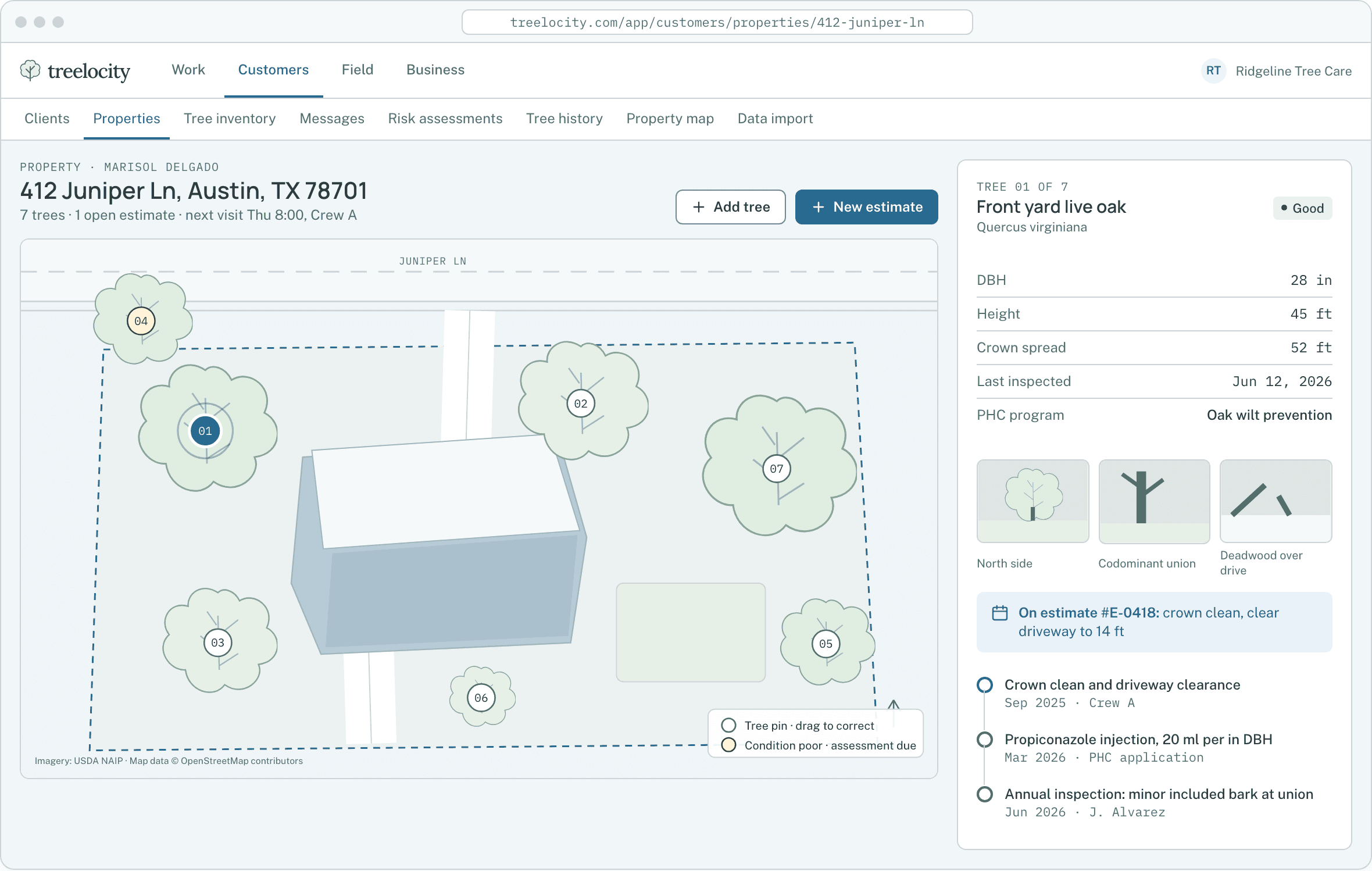
Property tree inventory and aerial map view.Example data - 2
Draw areas for beds, turf or canopy coverage
Tap corners around a canopy or treatment zone to calculate area in square feet or acres with instant undo.
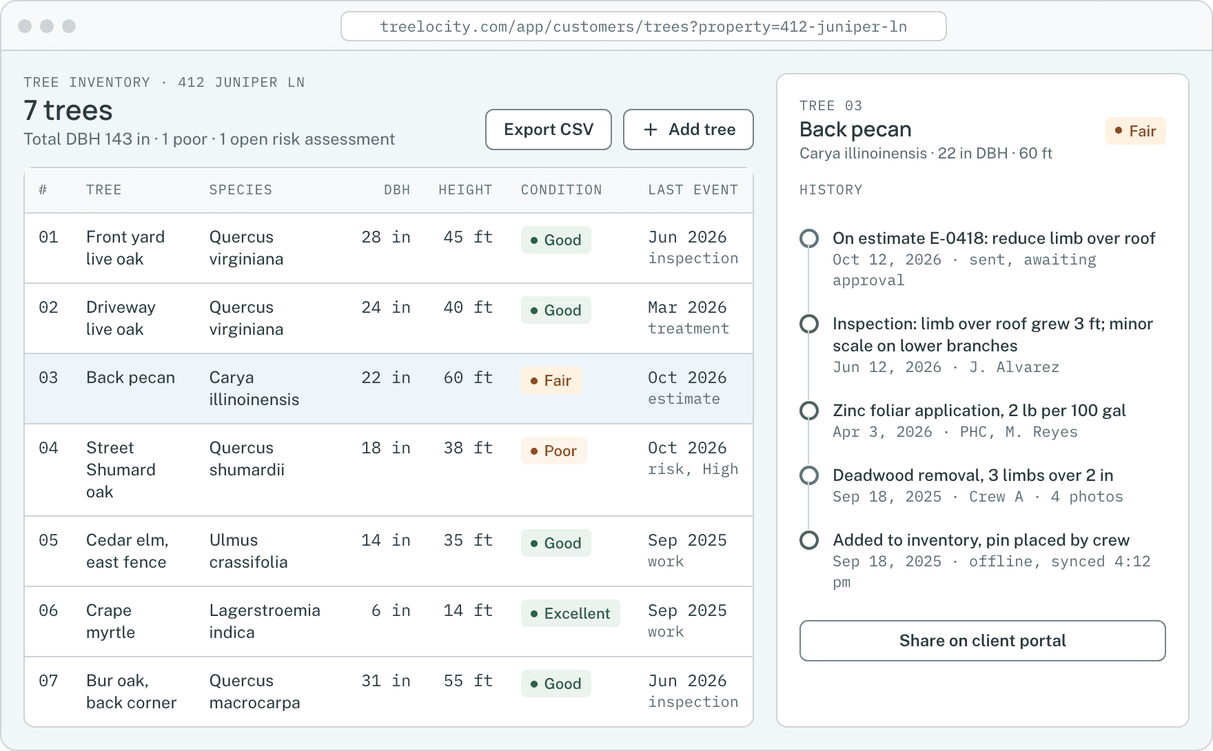
Tree canopy and bed measurements saved on the property record.Example data - 3
Measure drag distances to the chipper or crane pad
Draw a path from the trunk to the street to verify spray hose runs, crane reach and brush drag distances.
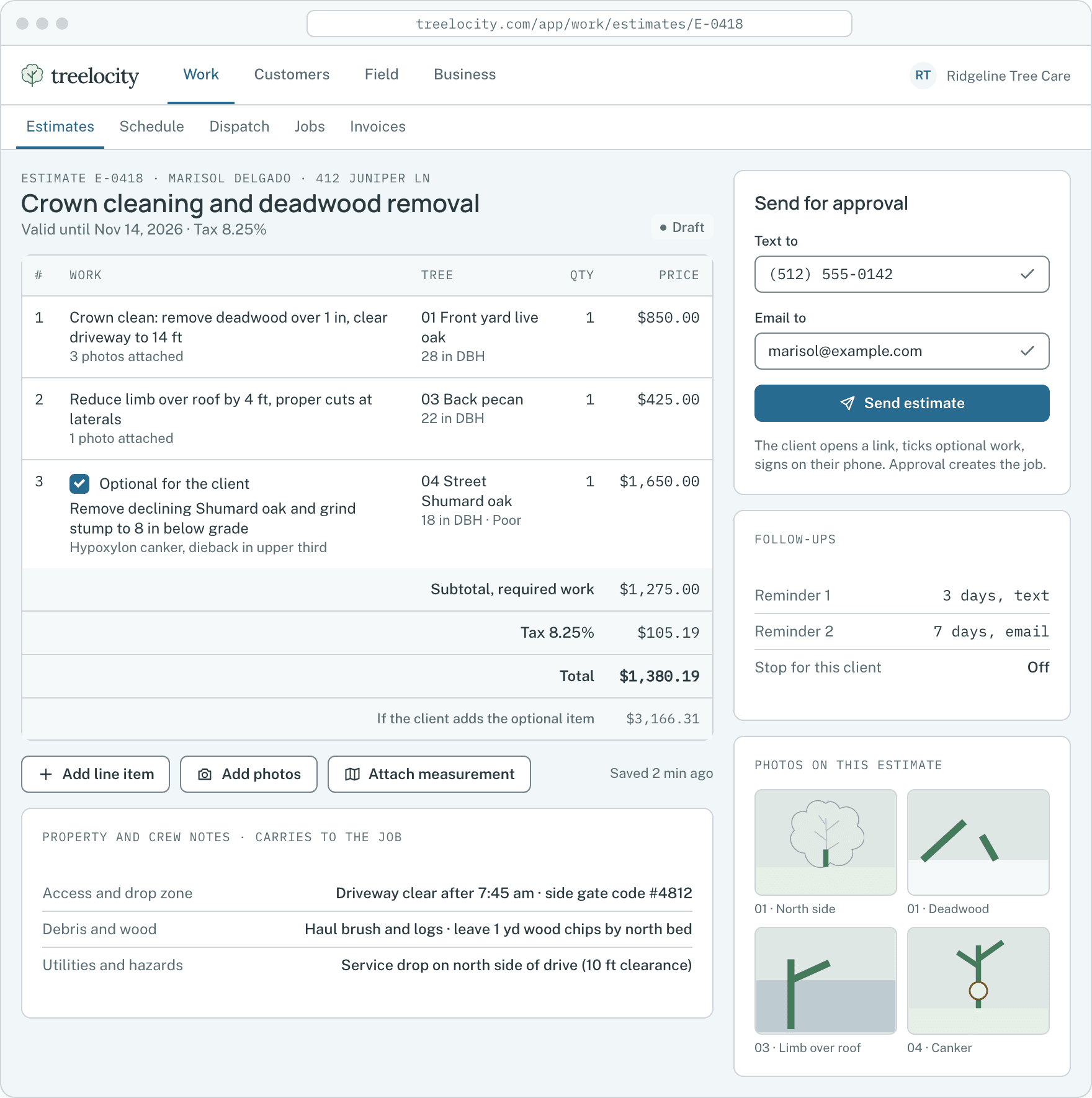
Measurement linked to an estimate line item.Example data - 4
Carry the measurement into the job for the crew
When the estimate is approved, the saved measurements remain visible to the crew on the job.
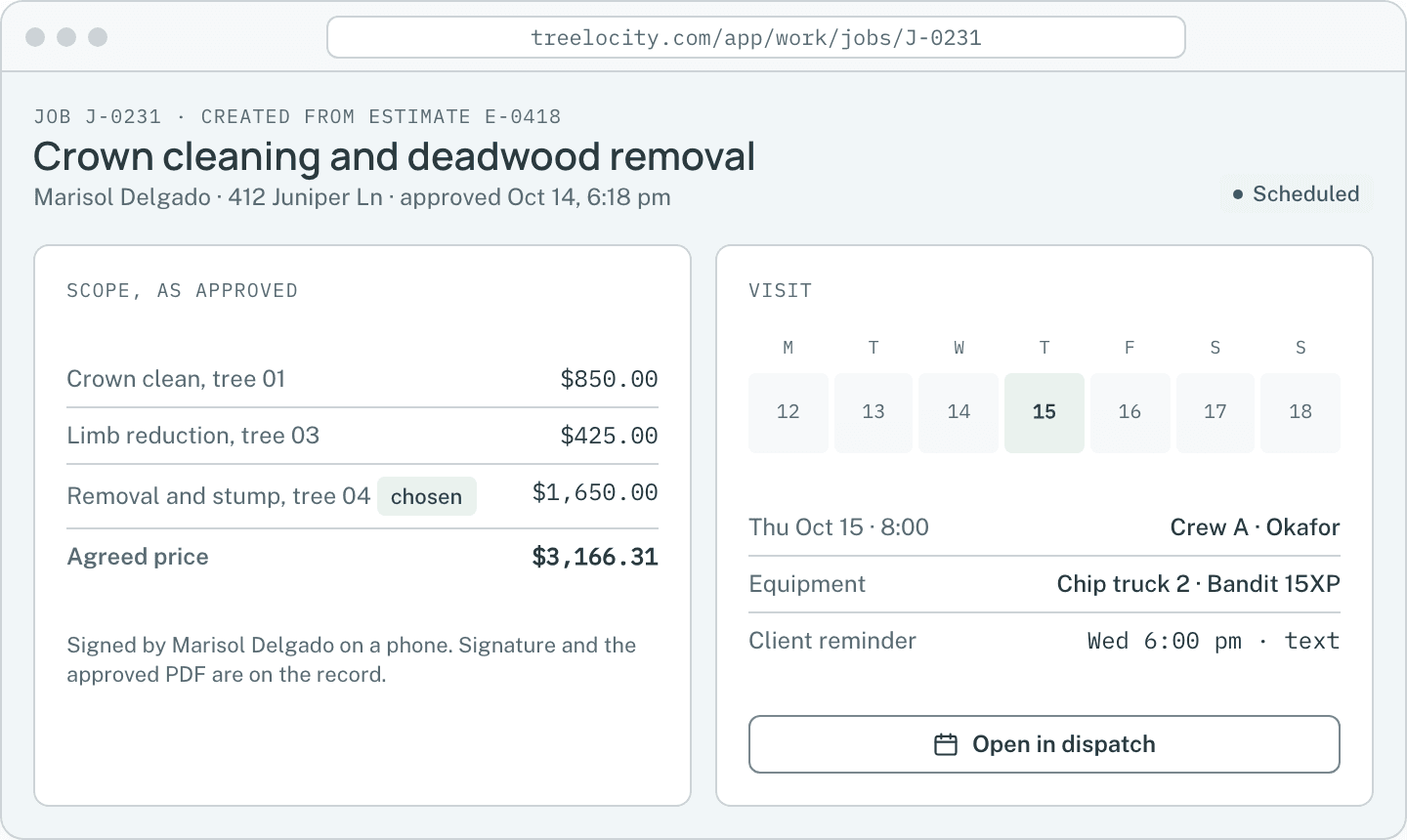
Job record with attached site details.Example data


What you get
What site measuring gives your estimators
Price mulch beds, PHC applications and long drags with measured numbers.
Draw canopy areas and drag paths
Trace mulch beds, treatment zones or brush drag paths right over the aerial map with one-tap undo.
CrewSaved directly to estimate line items
Measurements stay attached to the proposal line item they price and carry forward to the job.
CrewImagery capture dates shown clearly
Aerial map layers show when the satellite photo was captured so your estimator knows when to verify on site.
Crew
Common questions
Site measuring questions
How this workflow runs day to day in the office and on the truck.
Can I edit or delete a measurement after saving it?
Yes. You can undo points while drawing, or remove and redraw a measurement on any draft estimate.
Which plans include site measuring?
Site measuring is included in Crew ($199/month) and Established ($349/month).
Can estimators use site measuring on an iPad or phone in the driveway?
Yes. Drawing areas and distances works with touch on phones and tablets as well as with a mouse in the office.
What units does the measurement tool calculate?
Area drawings report square feet and acres, and linear paths report feet so you can price mulch, turf treatments or hose runs without manual conversion.
Get started
Measure your next property on the map.
Start a 14-day trial and test aerial measuring alongside your estimates.